Property Record
508 N Cusick St, Maryville, TN 37804


NEARBY LISTINGS FOR SALE OR LEASE
-
-
View all Maryville listings for sale on LoopNet.com
Property Detail
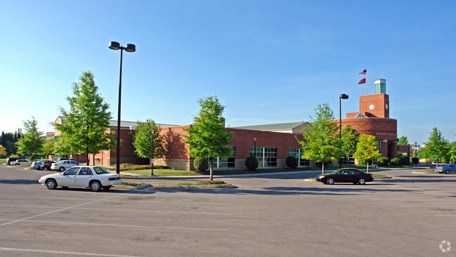
508 N Cusick St
Knoxville, TN
Lot 3
057D-C-029.00
LOT 3 3 NEW LIBRARY
Religious
Blount
X
Tennessee
47009C0138C
3
0
6.83 AC
2025
Blount County
010500
Knoxville
88,869 SF
DEMOGRAPHICS near 508 N Cusick St
1 Mile
3 Mile
5 Mile
2024 Total Population
7,378
46,127
79,100
2029 Population
7,999
50,103
86,000
Pop Growth 2024-2029
+ 8.42%
+ 8.62%
+ 8.72%
Average Age
39
41
41
2024 Total Households
2,881
18,493
31,657
HH Growth 2024-2029
+ 8.57%
+ 8.68%
+ 8.78%
Median Household Inc
$44,256
$57,330
$61,824
Avg Household Size
2.10
2.40
2.40
2024 Avg HH Vehicles
2.00
2.00
2.00
Median Home Value
$159,422
$218,484
$228,621
Median Year Built
1962
1977
1984
Nearby Places
Map Layers
Map Styles
 Street
 Aerial
- Restaurants
- Banks
- Shops
- Fitness
- Groceries
PUBLIC TRANSPORTATION
AIRPORT
McGhee Tyson
DRIVE
WALK
Distance
McGhee Tyson
14 min
7.7 mi
Freight Ports
Georgia Ports - Savannah
DRIVE
WALK
Distance
Georgia Ports - Savannah
490 min
418.8 mi
Nearby Properties
Address
Land Use
TOTAL SIZE
Lot Size
Zoning
Address
Land Use
TOTAL SIZE
Lot Size
Zoning
326,318 SF
IND
Address
Land Use
TOTAL SIZE
Lot Size
Zoning
194,621 SF
10.13 AC
CC
Address
Land Use
TOTAL SIZE
Lot Size
Zoning
75,124 SF
9.11 AC
E
Address
Land Use
TOTAL SIZE
Lot Size
Zoning
144,298 SF
4.49 AC
G
Address
Land Use
TOTAL SIZE
Lot Size
Zoning
516,444 SF
83.49 AC
IND
Address
Land Use
TOTAL SIZE
Lot Size
Zoning
150,532 SF
5.39 AC
G
Address
Land Use
TOTAL SIZE
Lot Size
Zoning
194,268 SF
33.99 AC
IND
Address
Land Use
TOTAL SIZE
Lot Size
Zoning
10,061 SF
22.74 AC
SPLIT
Address
Land Use
TOTAL SIZE
Lot Size
Zoning
101,640 SF
7.41 AC
SPLIT
Address
Land Use
TOTAL SIZE
Lot Size
Zoning
26,024 SF
16.24 AC
C
Address
Land Use
TOTAL SIZE
Lot Size
Zoning
64,033 SF
5.65 AC
O-3
Address
Land Use
TOTAL SIZE
Lot Size
Zoning
23,916 SF
9.94 AC
E1
Address
Land Use
TOTAL SIZE
Lot Size
Zoning
33,912 SF
19.91 AC
HDR
Address
Land Use
TOTAL SIZE
Lot Size
Zoning
74,071 SF
5.19 AC
HIC
Address
Land Use
TOTAL SIZE
Lot Size
Zoning
158,466 SF
14.78 AC
E1
Address
Land Use
TOTAL SIZE
Lot Size
Zoning
102,661 SF
17.27 AC
BT
Address
Land Use
TOTAL SIZE
Lot Size
Zoning
41,938 SF
7.42 AC
BT
Address
Land Use
TOTAL SIZE
Lot Size
Zoning
122,648 SF
0.10 AC
CBD
Address
Land Use
TOTAL SIZE
Lot Size
Zoning
323,040 SF
87.30 AC
IND
Address
Land Use
TOTAL SIZE
Lot Size
Zoning
45,913 SF
9.18 AC
RSF
Address
Land Use
TOTAL SIZE
Lot Size
Zoning
55,708 SF
6.95 AC
BT
Address
Land Use
TOTAL SIZE
Lot Size
Zoning
153,883 SF
IND
Address
Land Use
TOTAL SIZE
Lot Size
Zoning
104,327 SF
26.19 AC
CC
Address
Land Use
TOTAL SIZE
Lot Size
Zoning
156,895 SF
45.10 AC
IND
Address
Land Use
TOTAL SIZE
Lot Size
Zoning
106,466 SF
2.65 AC
CC
Address
Land Use
TOTAL SIZE
Lot Size
Zoning
172.05 AC
G
Address
Land Use
TOTAL SIZE
Lot Size
Zoning
295,555 SF
IND
Address
Land Use
TOTAL SIZE
Lot Size
Zoning
96,738 SF
23.34 AC
F
Address
Land Use
TOTAL SIZE
Lot Size
Zoning
46,164 SF
3.72 AC
WSCC
The World's #1 Commercial Real Estate Marketplace
Connect with us
© 2025 CoStar Group
The information above has been obtained from sources believed reliable. While we do not doubt its accuracy we have not verified it and make no guarantee, warranty or representation about it. It is your responsibility to independently confirm its accuracy and completeness. Any projections, opinions, assumptions, or estimates used are for example only and do not represent the current or future performance of the property. The value of this transaction to you depends on tax and other factors which should be evaluated by your tax, financial, and legal advisors. You and your advisors should conduct a careful, independent investigation of the property to determine to your satisfaction the suitability of the property for your needs.